

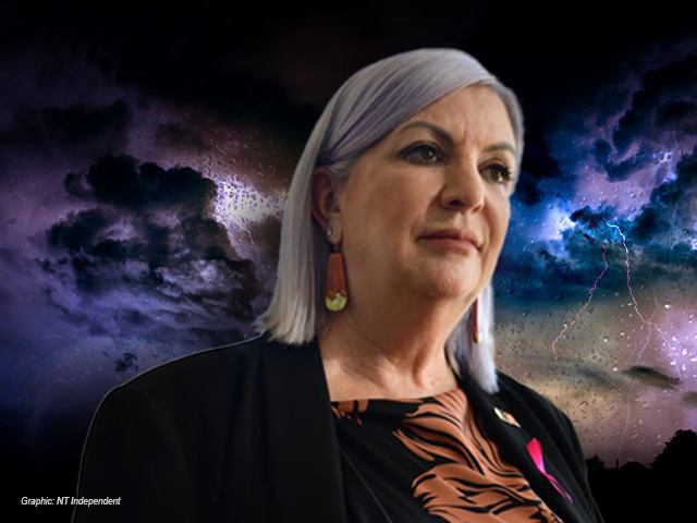
Trade and Business Minister Robyn Cahill’s claim that the Earth’s poles can flip during periods of heavy rainfall in the Northern Territory and that the water causes the Earth’s axis to shift is incorrect and shows she has a “very poor and terrible understanding” of how hydrology works, a leading expert in satellite hydrology says.
The Minister made the comments ahead of the NT Investment Summit in Darwin last Wednesday while discussing how water would be supplied to Energy North’s proposed Project Ares data centre on Murranji Station, about 52 kilometres northwest of Elliott. The project is expected to include approximately 90 hectares of data centre buildings.
The comments also followed previous NT Independent reporting that revealed the former Fyles Labor government doubled the modelled recharge rate for the Georgina Basin and introduced a recharge figure for the Wiso Basin without explaining how or why those changes were made.
Project Ares’s plan to use groundwater from the Montejinni Limestone Aquifer, part of the Wiso Basin, appears to have never had legitimate modelling done to estimate how quickly it recharges.
“The water supply is already in existence. It’s mainly subterranean. It’s extensive,” Ms Cahill said. “The water supply that Darwin has is extraordinary.
“There’s scientific evidence to suggest that we have so much water underground in the Northern Territory that it actually impacts the axis of the Earth when we have a really bad wet season.
“So, so we need to use some of it, otherwise we might find ourselves flipping the poles again.”

Griffith University School of Environment and Science senior lecturer Dr Christopher Ndehedehe leads the Earth Observation and Geomatics Group, is affiliated with the Australian Rivers Institute, and specialises in terrestrial hydrology, climate science and groundwater.
Dr Ndehedehe said Ms Cahill’s comments demonstrated a “very poor and terrible understanding” of hydrology, adding that misunderstandings of water science were an ongoing problem within the NT Government.
He pointed to the study Drift of Earth’s Pole Confirms Groundwater Depletion as a Significant Contributor to Global Sea Level Rise 1993–2010, found that depletion of underground water storages through use on the surface contributed to the spinning of the Earth’s axis.
“There is no basis for that [claim that heavy rainfall in the NT changes the Earth’s axis],” Dr Ndehedehe said.
“There is no such info in the literature. That is completely incorrect and false.
Ms Cahill was unavailable to clarify what scientific evidence she was relying on when contacted on Friday.
Instead, Trade, Business and Asian Relations chief executive Hayley Richards said in a statement that the Minister was referring to peer-reviewed research on the use of gravity measurements by satellite to estimate changes in terrestrial water storage through NASA’s Gravity Recovery and Climate Experiment (GRACE) mission.
“GRACE satellites measure changes in gravity linked to water movement across groundwater, soil moisture, lakes and rivers, providing insights into large fluctuations in water availability such as from monsoons or deep droughts,” Ms Richards said.
“GRACE data verifies that when water levels the Georgina-Wiso [basin] responded strongly to the very large wet seasons in 2021-23, the gravity of the earth as measured by those satellites, changed.
“This is due to the water filling up the aquifers deep underground and increasing the mass at scale which increased the gravitational pull in the Georgina-Wiso.”
Dr Ndehedehe broadly agreed with the first points but said wet season water could be stored in lakes, rivers, soil moisture, or groundwater, together called terrestrial water storage, adding other data was needed to tell how much was in the aquifers.
He said while there was GRACE-derived terrestrial water storage in the NT following improved rainfall in 2023 and 2024 those were short-term changes that do not completely offset the impacts of declining storage conditions that persisted for a decade as reported in a 2005 Cambrian Limestone Aquifer study he led called, Tracking freshwater depletion in Northern Australia: A multi-satellite approach, which was first published earlier in the international academic science journal, Ecological Informatics.
“This extra water from rainfall increases the surface mass of the region, which is detected by the satellites as a change in Earth’s gravity field,” Dr Ndehedehe said.
“However, GRACE measures terrestrial water storage, so auxiliary data, such as surface water and soil moisture storage from models, are needed to estimate changes in aquifers over a basin or region.
“It is only after this analysis that you can say the increase came specifically from groundwater filling the aquifers.”
Ironically in response to that study in 2025, the NT Department of Lands, Planning and Environment Water Resources’ acting executive director Nerida Beard issued an extraordinary press release criticising the peer-reviewed study for relying too heavily on GRACE, saying it was a flawed method.
She said separating groundwater storage from water stored in soil, rivers and lakes introduced uncertainty, and GRACE data could not identify the cause of water storage changes. She added that the government’s scientific understanding showed groundwater levels were primarily driven by climate variability, with water extraction for irrigation and other uses making only a minimal contribution.
In a detailed written response last year, the study’s authors said the government’s allegation about their work was “flawed” and lacked any supporting peer-reviewed literature, data or analysis, and said they were serious and potentially defamatory claims, identifying five points which they said were misleading or inaccurate by the department.
Read: Opinion: Behind the meter – the unanswered questions behind the Barkly’s AI data centre

In 2020, the NT Government commissioned a consultancy to model groundwater recharge rates for the Georgina, Wiso and Daly basins, which are interconnected parts of the broader Cambrian Limestone Aquifer, to determine how much water could be allocated to industries including agriculture, mining and hydraulic fracturing.
Hydrologist Mark Knapton’s report estimated an annual recharge of 315 gigalitres for the Georgina Basin, but did not provide a recharge figure for the Wiso Basin.
However, in November 2023, the NT Government reported recharge figures of 607GL for the Georgina and 45GL for the Wiso to the same modelling.
Both then-chief minister Natasha Fyles and then-environment minister Lauren Moss refused to answer questions and to explain the science behind both figures.
It prompted questions from RMIT Professor Matthew Currell about how those figures were derived.
He was engaged to produce a report on the Cambrian aquifer for the Environment Centre NT, in which he cited seven studies, including his own, that estimated recharge rates for various basins.
He said the government’s paper was the only one to provide a recharge estimate for the Wiso Basin.

The Georgina-Wiso Water Allocation Plan, released in 2025, allocated 210 GL of water a year, with an additional 10 GL reserved for hydraulic fracturing and 20 GL set aside as an Aboriginal water reserve.
Environment Centre NT director Dr Kirsty Howey said at the time the modelling the government had used was based on the last 50 years of data only, which was skewed by an extremely large recharge during Cyclone Tracy when roughly 20,000 GL was recharged.
Dr Howey said on Monday that Ms Cahill’s comments would be funny if they were not so serious.
“The Minister appears to believe that the Northern Territory’s wet season can alter Earth’s axis, which has no scientific basis. It’s completely cooked,” Dr Howey said.
“This would be funny if the risks posed by data centres and fracking weren’t so serious, but the Territory’s future is at stake.
“It’s frightening that the people in charge of regulating dangerous industries like fracking and data centres seem to lack even a high-school understanding of water science.”

Dr Howey criticised the Finocchiaro Government’s ambition to make the Northern Territory the “data centre of the globe”, saying it had dismissed the risks to groundwater supplies in some of Australia’s most arid regions despite acknowledging that 12 proponents were seeking to build data centres.
“Let’s not forget that water is free in the Territory. We don’t want to see our precious aquifers drained for AI while we get nothing in return,” Dr Howey said.
“In its submission on Project Ayres, ECNT estimated that data centres of a similar size would ordinarily require a 25GL of water per year – equivalent to 10,000 Olympic swimming pools.
“The Environment Centre NT is concerned they are a trojan horse for Territory fracking due to the astronomically high power requirements of AI generation.
“The frenzied roll out of data centres comes amid a renewed push by industry and the NT Government for fracking in the Beetaloo Basin – stuck in the exploration stage for over two decades – to finally move to production.
“Which could see up to 6000 wells drilled through the Territory’s underground water supplies, and 1.2 billion tonnes of greenhouse gas emissions generated.”

for more details, see: https://darwin.click/aint
Saying that groundwater usage affects the earth’s tilt is a bit like saying an ant crawling on a cruise ship makes it rock more. The earth is BIG.
The Member for Port Darwin is never wrong! She is highly respected as a trade minister and when she visits them traditional and conservative South East Asian Countries on important trade visits, you should see the unique look on the respective trade ministers as they admire her keen fashion sense.
“ما هذا بحق الجحيم؟” is uttered everywhere!
In Indonesia they utter “Itu apaan sih?”
In Thailand the Trade Minister said “นั่นมันอะไรกันเนี่ย?” under his breath
Mate she is unforgettable and great value to the Territory!